Exploring the Historic Lighthouses of Islay, Scotland
Islay Lighthouses: History, Coastal Walks and Historic Landmarks
Discover the fascinating maritime history, dramatic coastal scenery, and remarkable lighthouses that have guided ships around Scotland’s beautiful Isle of Islay for generations.
A Journey Along Islay’s Lighthouse Coast
Scattered around Scotland’s rugged coastline, lighthouses have played a vital role in protecting sailors and guiding vessels through dangerous waters. On the Isle of Islay, these historic structures are more than navigational aids. They are reminders of the island’s maritime heritage, the challenges faced by generations of lighthouse keepers, and the engineering achievements that helped make coastal travel safer.
Today, Scotland’s lighthouses are managed by the Northern Lighthouse Board, and their lighting systems operate automatically. This is a significant change from earlier centuries, when keepers depended on flames, oil lamps, and other traditional sources of illumination. The introduction of automation also brought an end to the demanding routine of living at isolated stations for extended periods.
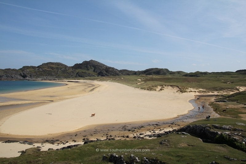
Islay, situated in the southern part of the Inner Hebrides, is particularly well suited to exploring this history. Its indented coastline, rocky shores, and exposed headlands have long presented challenges to shipping. With Loch Gruinart and Loch Indaal reaching deep into the island, Islay has an extensive coastline of approximately 155 miles, much of it shaped by the surrounding Atlantic waters.
Hidden reefs and submerged rocks once posed serious threats to passing vessels. Over time, a network of lighthouses was established to help ships navigate these hazardous stretches of sea.

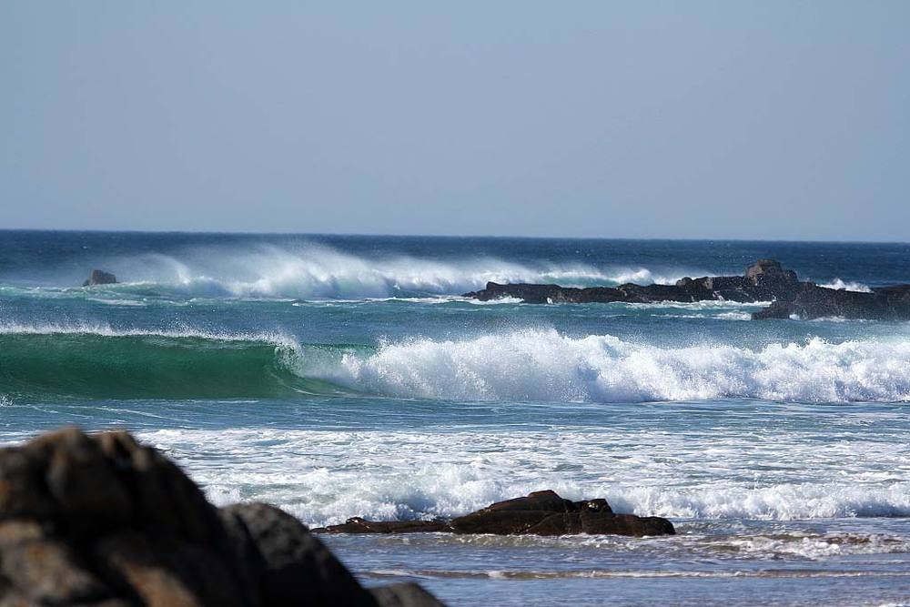
The Shipwreck That Left a Lasting Mark
The importance of Islay’s coastal lights becomes especially clear when considering the tragedies that occurred before navigation became more reliable.
One of the island’s most heartbreaking maritime disasters involved the Exmouth Castle. In April 1847, the vessel was lost after the Rhinns of Islay Lighthouse was reportedly mistaken for the light on Tory Island. The disaster claimed the lives of 241 emigrants, including men, women, and children.
A memorial near Sanaigmore Bay commemorates those who died.

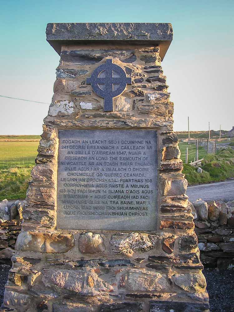
This tragic event illustrates the enormous responsibility carried by lighthouse builders and keepers. A light visible across miles of dark, unpredictable sea could mean the difference between reaching safety and disaster. As commercial shipping and passenger travel increased, the need for dependable coastal navigation became increasingly urgent.
How Islay’s Lighthouses Came to Be
Advances in construction techniques and lighthouse engineering gradually made it possible to build warning lights in increasingly difficult locations. Although Islay was less isolated than some of Scotland’s more exposed lighthouse sites, its coastline still demanded considerable skill and determination.
Seven lighthouses were constructed around Islay between 1825 and 1928, each serving a particular stretch of coastline or maritime approach.
The Stevenson family played an important part in this development. Robert Stevenson (1772–1850), one of Scotland’s most influential lighthouse engineers, designed numerous coastal lights, including the Rhinns of Islay Lighthouse. His sons, David and Thomas Stevenson, continued the family tradition and contributed to the development of lighthouse engineering throughout Scotland.
Their work helped establish a system of coastal lights that continues to form an important part of Scotland’s maritime infrastructure.

Rhinns of Islay Lighthouse: The Island’s Oldest
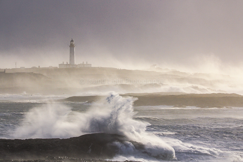
Located on Orsay, a small island close to Portnahaven, the Rhinns of Islay Lighthouse is one of the most significant landmarks in Islay’s maritime history.
First illuminated in 1825, the tower rises approximately 95 feet and has guided vessels approaching the island for two centuries. Its position on the western side of Islay makes it an important feature of the surrounding seascape.
The lighthouse was automated on 31 March 1998. Its white light flashes at five-second intervals, continuing a tradition of maritime protection that began long before modern navigation systems existed.
Life at the station was once considerably more demanding. Supplies had to be transported by boat, and boatmen also served as relief keepers when necessary. Bad weather could make even routine journeys difficult, leaving the lighthouse and its keepers isolated until conditions improved.
Today, the lighthouse stands as a reminder of the people who maintained these remote stations and the essential work they carried out in challenging circumstances.
Ruvaal Lighthouse: Watching Over Islay’s Northern Waters
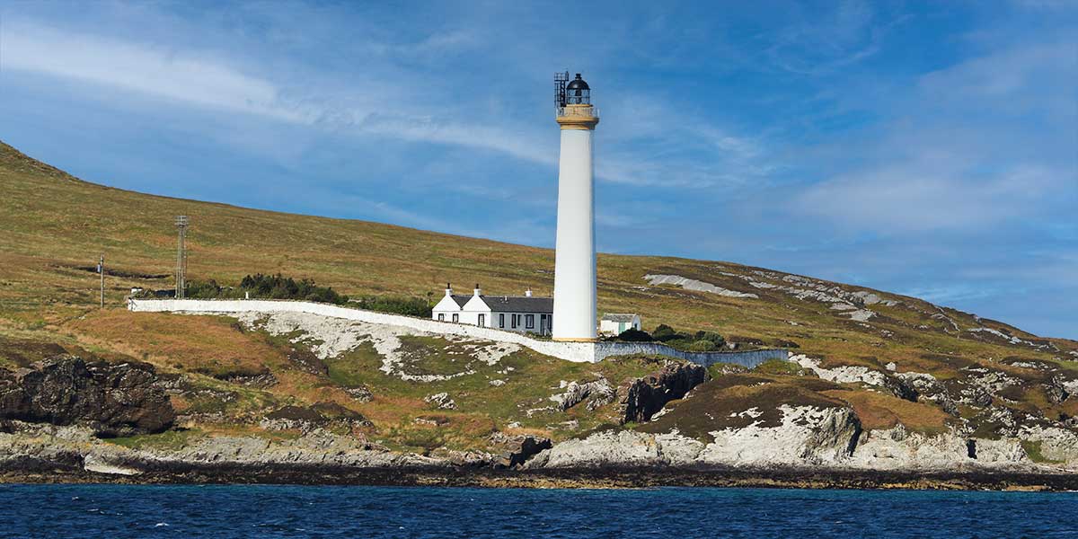
At the northern end of Islay, Ruvaal Lighthouse overlooks the entrance to the Sound of Islay, a busy stretch of water separating Islay from the neighbouring island of Jura.
Completed in January 1859, the lighthouse was designed to provide a visible warning to vessels navigating the surrounding waters. Its tower rises approximately 100 feet, allowing the light to be seen from areas such as the Neva Rocks to the west.
Ferry passengers travelling between Port Askaig and Colonsay may be able to spot the lighthouse during their journey, making it an interesting landmark for visitors exploring the island by sea.
The station’s former residential buildings, enclosed within a white-walled garden, have since become a private home.

The Difficult Life of a Lighthouse Keeper
Reaching Ruvaal was once a serious undertaking, particularly during winter. The journey from Port Askaig was around six miles, and keepers relied on boats whenever the weather allowed.
When rough seas made sailing unsafe, walking became the only practical alternative. Strong winds, persistent rain, and poor conditions could turn the journey into an exhausting experience.
If a keeper had walked to the lighthouse because the boat could not be used, the return trip might also have to be completed on foot. These journeys offer a glimpse into the resilience required of those who maintained Islay’s coastal lights before modern transport and communication made the work easier.
McArthur’s Head Lighthouse: Dramatic Views Across the Sound
McArthur’s Head Lighthouse occupies an elevated position above the Sound of Islay and is a familiar sight for people travelling by ferry to Port Askaig.
Established in 1861, its tower stands approximately 43 feet tall, with the light positioned about 128 feet above sea level. The signal flashes every ten seconds, helping vessels navigate this stretch of water.
The lighthouse is particularly appealing to walkers and photographers because of its rugged setting and views across to Jura.
A Coastal Walk Worth the Effort
One approach begins at Ardtalla and continues via the bothy at Proaig, an area known as a good place to look for otters. The route offers beautiful coastal scenery, although the steep climb from the shore can become slippery and hazardous after rainfall.
Visitors who arrive early in the year may discover daffodils flowering in the former lighthouse garden, adding a seasonal touch to the landscape.
Another possible approach is from Port Askaig, although the journey requires considerable effort.
The challenges of reaching McArthur’s Head were once part of everyday working life for lighthouse keepers. Dougie MacDougall, who served the lights along the Sound of Islay for 45 years before retiring in 1977, recalled difficult walks of approximately six miles. During periods of heavy rain, streams could swell dramatically, forcing him to wade through freezing water.
With no telephone at home, his family could be left wondering whether he had reached the lighthouse safely. His experiences illustrate how isolated lighthouse work could be, even when the station was not far from inhabited parts of the island.
More on Dougie MacDougall here: https://islay.scot/dougie-macdougall-islay-in-the-oiden-days/

Loch Indaal Lighthouse: A Landmark Near the Road
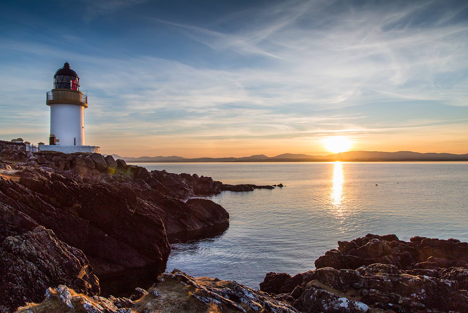
Also known as Ribh’ an Duin, Loch Indaal Lighthouse is one of the more accessible lights on Islay.
Situated close to the road connecting Port Charlotte and Bruichladdich, it is easier to reach than several of the island’s more remote coastal structures.
Established in 1869, the lighthouse has a tower approximately 43 feet high, and its white light flashes every seven seconds. The adjoining buildings are now privately owned.
Although the lighthouse itself is not a conventional tourist attraction with public facilities, its location makes it a worthwhile stop for anyone exploring the western side of Islay.
The surrounding landscape provides opportunities for photography, particularly when the light, sky, and waters of Loch Indaal come together to create a memorable coastal scene. Visitors can obtain views from the surrounding area, but should respect private property and avoid entering enclosed land without permission.
Eilean a’ Chuirn: A Lighthouse in an Isolated Setting
For those interested in the remoter corners of Islay’s maritime landscape, Eilean a’ Chuirn is particularly intriguing.
Constructed in 1907, it stands on a small island off the southeastern part of Islay. Although it is only around six miles offshore, its position makes it one of the island’s most isolated lighthouse sites.
The structure rises approximately 56 feet, with its light situated around 85 feet above sea level. It produces three white flashes every 18 seconds.
Its location reflects the practical challenges faced by lighthouse engineers: a navigational light had to be placed where it could serve approaching vessels effectively, even when that meant building on a small, exposed island.
Unlike lighthouses close to roads or ferry terminals, remote sites such as Eilean a’ Chuirn are difficult to visit directly. Nevertheless, they remain an important part of the wider network that has helped vessels travel safely around Islay.
Carraig Mhor: A Small Lighthouse with an Important Role
Carraig Mhor Lighthouse is located in the Sound of Islay, just south of Port Askaig.
Completed in 1928, it is the most recently built of the island’s traditional lighthouse structures. It is also remarkably small, with a tower measuring only around seven feet high and an elevation of approximately 23 feet above sea level.
Despite its modest size, the light serves an important navigational purpose. It flashes once every six seconds, helping vessels identify hazards and navigate the surrounding waters.
Carraig Mhor demonstrates that the importance of a lighthouse is not necessarily determined by the height of its tower. Position, visibility, and the specific navigational hazards being marked are equally important.
Its setting also makes it an interesting feature for visitors exploring the Sound of Islay and the surrounding coastline.

Carraig Fhada Lighthouse: A Memorial to Lady Ellenor
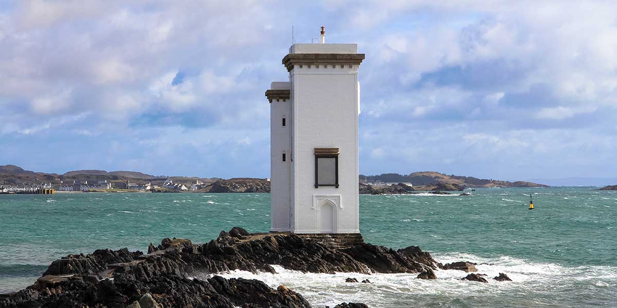
Among Islay’s lighthouses, Carraig Fhada is perhaps the most distinctive in appearance.
Located on a rocky headland near Kilnaughton Bay, opposite the Port Ellen ferry terminal, it is easily recognised by its unusual design of two connected square towers. Its striking silhouette has made it one of Islay’s best-known coastal landmarks.
The lighthouse is closely associated with Walter Frederick Campbell, who founded the village of Port Ellen in 1821. Campbell inherited Islay at the age of 18 and later commissioned the lighthouse in memory of his wife, Eleanor, who died in 1832.
The lighthouse is the second oldest on the island and continues to flash its warning light at three-second intervals.
Visiting Carraig Fhada
Carraig Fhada is among the more accessible lighthouses for visitors exploring Islay. Parking near the end of the graveyard provides a convenient starting point for the short approach.
A narrow concrete path passes between exposed rock formations, leading towards a metal bridge approximately 20 feet long. The bridge crosses a cleft through which seawater flows, creating a dramatic feature of the approach.
Care is essential, particularly when the surface is wet or the sea is rough.
Above the lighthouse entrance, a stone plaque commemorates Lady Ellenor, providing a direct connection between the structure and the personal story behind its construction.
The Story Behind the Memorial
Campbell also commissioned a double sarcophagus for himself and his wife. Although Lady Ellenor’s remains are in Bowmore Church, Campbell was buried elsewhere.
His later years were troubled by financial difficulties, and he died abroad at the age of 32.
While the personal story of the couple may be less familiar today, the lighthouse remains a lasting memorial. Its continued operation ensures that Campbell’s tribute to his wife has endured far beyond the circumstances of their lives.
Discovering Islay Through Its Lighthouses
Exploring Islay’s lighthouses offers a different way to experience the island. Beyond the distilleries, villages, beaches, and wildlife for which Islay is widely known, these structures reveal a history shaped by the sea and by the people who worked to make its waters safer.
Some stand close to roads and ferry routes, while others occupy remote islands or exposed headlands. Each has its own character, from the distinctive double towers of Carraig Fhada to the modest structure at Carraig Mhor.
Together, they tell a story of engineering, hardship, tragedy, and perseverance. They also provide wonderful opportunities to discover Islay’s varied coastal landscapes, whether through a short roadside stop, a longer walk, or a view from a passing ferry.
For anyone interested in Scottish history, maritime heritage, photography, or coastal walking, Islay’s lighthouses are well worth discovering.
Their keepers may no longer live in isolation, and their lights may operate automatically, but their purpose remains unchanged: to help guide vessels safely through the waters surrounding one of Scotland’s most captivating islands.
More about Islay on https://islay.scot